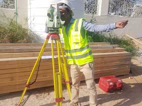
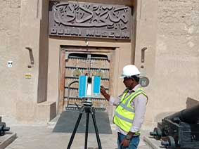
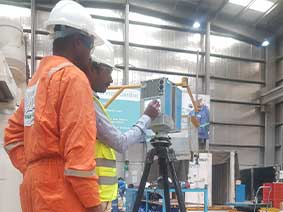
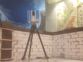
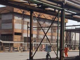
Arabic AR English EN
NS-Logo-Updated
Arabic AR English EN

3D Modelling Services
Reduce your project time and cost – Effective solution
3D Modelling Services
Reduce your project time and cost – Effective solution
3D Modelling Services
Reduce your project time and cost – Effective solution
Previous
Next

About Us

Neusurvey is a leading surveying business that offers a wide range of solutions for a wide variety of industries. Among our services are onshore & offshore Oil & Gas Field Services, 3D laser scanning, BIM modelling, construction and land surveys.

With our long history of experience and a team of well-versed professionals, Neusurvey provides accurate and exhaustive information about properties and construction projects. We utilize the latest technology and techniques in surveying to help you make informed decisions and achieve your goals, regardless of whether you are an oil field designer, property developer, Construction Company, or a landowner.

To provide our clients with the most cost-effective surveying solution in the region, Neusurvey uses the latest proven equipment in the field and the most cost-effective technology and surveying solution in the region.

The Company management remain very much “hands on” and are personally involved to ensure the successful outcome of all projects. Learn more about how Neusurvey can assist you with your surveying needs by contacting us today.

3D Laser Scanning

Our innovative 3D laser scanning service at Neusurvey gives your designers and engineers a completely functional 3D model of the entire site in the best format possible (e.g.: 3D PDF, AutoCAD, Revit,12D). Then, from every angle and vantage point, you may view and measure every potential data point at your site.
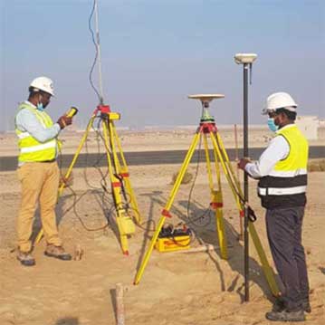
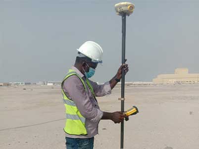
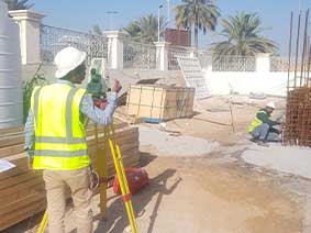
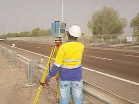
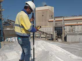
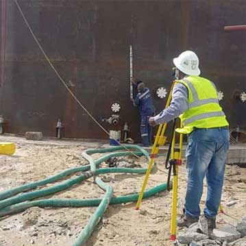
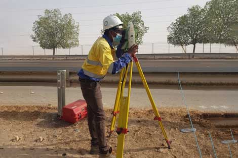
Land Survey

Surveys of the topography, engineering and construction projects, hydrographic data, GIS development and updates, exploration, route surveys, and audit and quality control surveys.
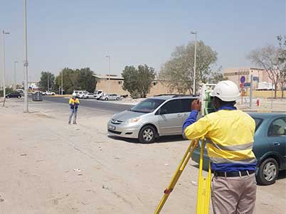
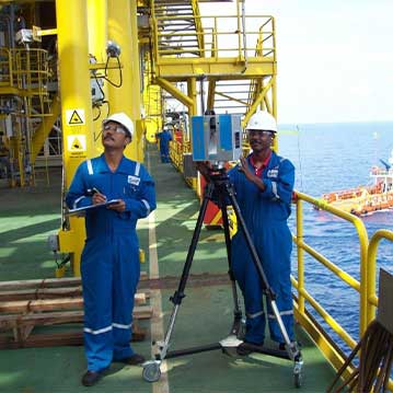
And More

Hydrographic survey, on-site and offshore oil and gas field surveys, the hiring of draughtsmen and draughting services, the hiring of survey teams with survey equipment, Building As Built Survey, Monitoring Survey & Documentation, Survey Support for Aluminum Cladding Work of Multi-Storeyed Building, Road Alignment Surveys, and Establishment of Control Points/Benchmarks (Triangulation Static Method) are some of the services offered.
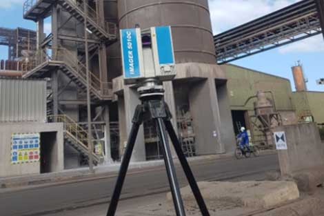
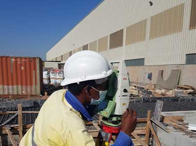
Our Services

kappal
3D Laser Scanning

3D laser scanning is a process that uses lasers to capture three-dimensional data from physical objects and environments. This technology is often used in engineering, construction, and architecture to create accurate and detailed models of existing structures and landscapes.

nuesurvey-home-change-img
3D Solid Modeling and Architecture Modeling From Point Cloud

3D solid modeling is the process of creating a three-dimensional digital representation of an object or structure using specialized software. Architecture modeling refers specifically to the creation of 3D models of buildings or other architectural structures.

Land Survey

This involves the measurement and mapping of land and its features, including boundaries, topography, and natural and man-made features.Construction surveying: This involves the measurement and mapping of construction sites and structures to ensure they are built according to the design specifications.

112 +
Projects Completed
50 +
Happy and Satisfied Clients

What will you get from us?

Our Expertise

3D Laser Scanning

3D laser scanning is considered one of the most efficient and accurate methods for measuring infrastructure. A 3D laser scanning survey involves the remote collection of data points from a building or structure at a higher speed and with a greater level of detail than conventional surveying techniques.

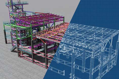
Building Information Modeling (BIM)

Building Information Modeling is the process of creating digital representations of functional and physical characteristics of spaces/facilities. BIM is important to the AEC industry as it allows businesses to approach projects with a higher level of insight and predictability.
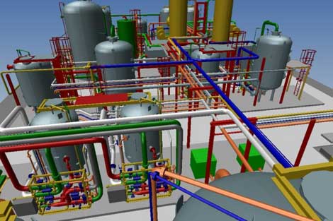
3D Modeling Service

Automatic, on-demand generation of accurate drawings and reports direct from the 3D model saves time and effort in the design office, eliminates sources of error and ensures that fabrication and construction use validated, up-to-date information.

Client Testimonials

Our Projects

Our Projects

Sheik Sayed Heritage Festival Topographical Survey and Preparation of Plan Drawing, Abu Dhabi
Etihad Rail Site Survey: Preparation of a Plan and Profile Drawing
Private Plot Topographical survey and Preparation of Plan drawing.
ADDC Project 3D Reality Laser Scan & Road Settlement Monitoring Survey – D107604 Package B.
Dubai Museum BIM modeling and 3D laser scanning for Al Fahid Fort Building survey and assessments.
C2 Capital View 3D Laser Scanning and Reality Capture
Road Settlement Monitoring Survey Dubai Al Ain Road
3D Laser Scanning and BIM model & 3D Coloured point cloud and virtual Reality for Siemens
3D As-Built Walkthorugh Modelling using point cloud data derived from 3D Laser Scanner 2nd Floor at Marina Mall
3D Laser scanning and modeling at Emirates Steel Arkan Abu Dhabi.
Al Gaith Industries - Salt Stockpile Quantity Survey