3D Laser Scanning
3D laser scanning is considered one of the most efficient and accurate methods for measuring infrastructure. A 3D laser scanning survey involves the remote collection of data points from a building or structure at a higher speed and with a greater level of detail than conventional surveying techniques. The captured set of data points (point cloud) are mapped on a grid coordinate system of x, y, and z.
In this article, we take a look at what 3D laser scanning is, the importance of 3D laser scanning, and some of the different types of 3D scanners.
What is a 3D Laser Scanner?
A 3D laser scanner is a surveying instrument that emits a laser beam from a rotating mirror towards the area being scanned. This laser beam is then distributed over a vertical range of 300° and a horizontal range of 360°, with the laser beam being reflected back to the scanner by any objects that are in its path.
The distance between objects and their angles are then captured, providing point cloud data, whereby a point cloud is a set of data points in a coordinate system with X, Y, and Z values representing the surface of objects.
Why is 3D Laser Scanning of Buildings Important?
Especially in the initial stages of a redesign, renovation, or maintenance project, it is important to capture existing conditions. Compared to more traditional surveying methods, 3D is less time-consuming, provides a greater amount of detail (reducing wasted time on site revisits), and is less intrusive.
As projects progress through the varying stages, 3D laser scanning can also be used to provide precise details that can be used by all involved in the project.
Types of 3D Laser Scanners
There are a variety of 3D laser scanners on the market, including:
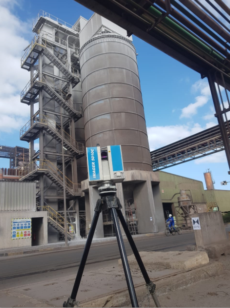
Stationary 3D Laser Scanners
Stationary 3D laser scanners, commonly referred to as terrestrial laser scanners, are stationary lasers that emit lasers in 360 degrees to cover the sphere around them. These tools are used to document vertical structures such as buildings, industrial facilities, and bridges. Stationary scanners document vertical structures, such as buildings, and produce the most accurate point cloud data.
Handheld Laser Scanners
Handheld 3D laser scanners emit a laser beam directly towards an object rather than producing a 360-degree scan and are more commonly used to scan smaller objects that are within close proximity.
Backpack 3D Laser Scanner
An individual wears a backpack-mounted 3D laser scanning device that records data as they move through a building. This method of laser scanning is less common compared to that of a stationary scanner.
Neusurvey
At Neusurvey, we use the latest 3D scanning technology, capturing over 1 million points per second, to produce surveys with exceptionally high levels of detail and functionality. With our final deliverable available in Z+F Laser Control, you can easily access and edit point cloud information.
We provide our scans in a variety of outputs, including 2D and 3D Autocad drawings, point clouds, and rectified images. If your project requires a 3D laser scanning survey, contact our surveyors for more information.
What are the benefits of 3D Laser Scanning?
- Reduce site visits, rework, and design times.
- Eliminate hot work and rework; the risk and costs associated with hot work, construction rework, and field fit-up welds are greatly reduced.
- Safety: eliminates the safety hazards of traditional field data capture and provides up-to-date facility documentation to facilitate maintenance.
- Reduced project risk: make confident decisions based on the best available current information.
- Quicker deliverables greatly reduce project start-up time.
- Completeness: accurate and detailed information improves engineering designs.
- Direct digital as-built data: designers now work with 3D computer models; digital 3D as-built data is more natural to their workflow.
- Designing directly in point clouds is rapidly gaining wide acceptance and developing into a very cost-effective work process by reducing the work of manipulating data into 3D models.
- Clash Detection: compare design with as-built to eliminate interferences.
- Only model what is needed for the immediate job; as long as an object is contained within the scan database, it can be modeled at any future time.